Berkas:Nepaul valley map 1802.jpg
Ukuran nan usali (3.012 × 2.916 piksel, ukuran berkas: 2,2 MB, tipe MIME: image/jpeg)
Ikhtisar
| Katarangan |
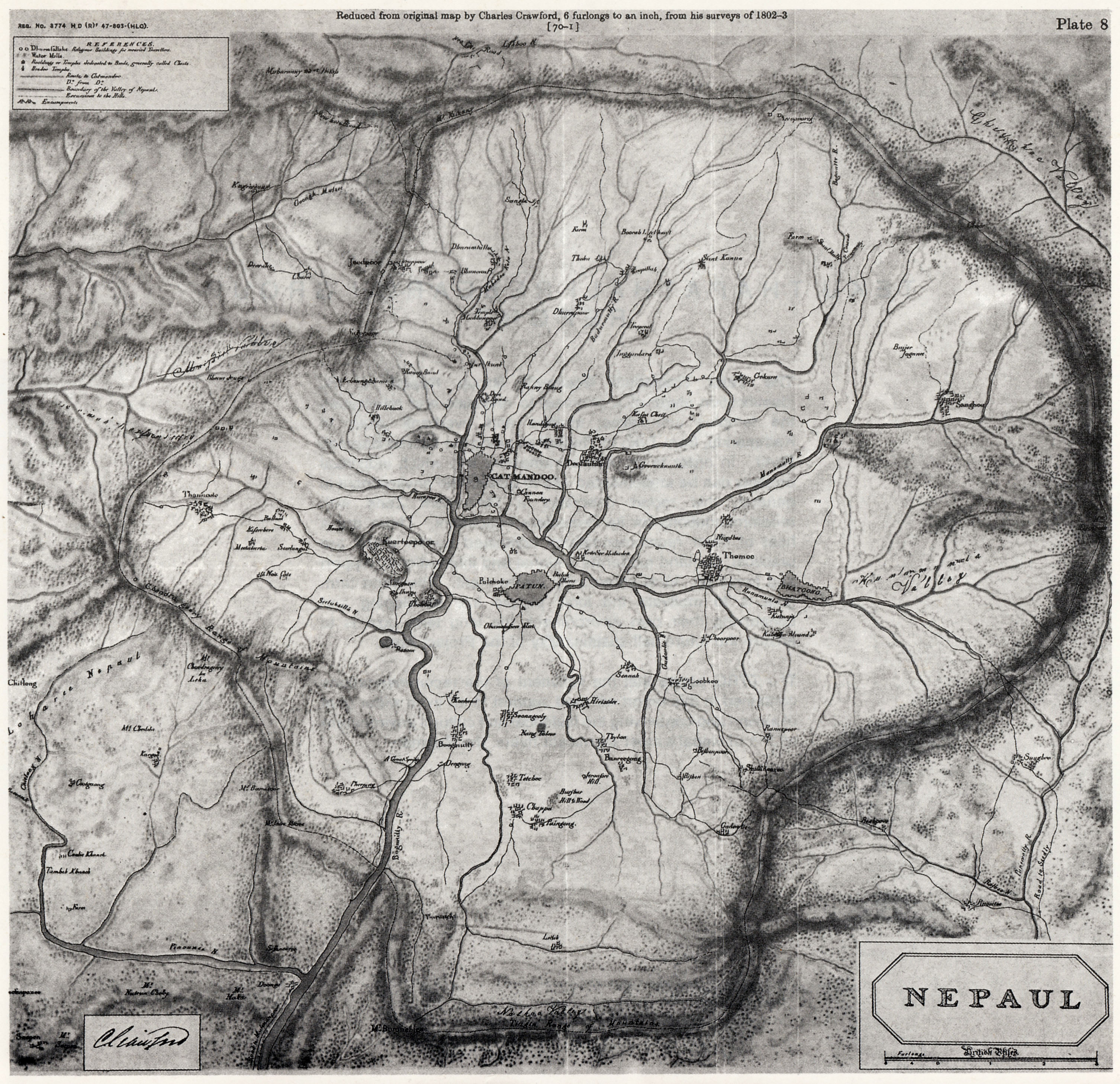
English: Scan of map of Nepaul, present-day Kathmandu Valley and surrounding areas in Nepal, made by Charles Crawford in 1802-03. |
| Tanggal | |
| Sumber | Karya surang |
| Pambuek | Zulufive |
Lisensi
|
This work is in the public domain in its country of origin and other countries and areas where the copyright term is the author's life plus 70 years or fewer.
| |
| Berkas ini telah diidentifikasi bebas dari pembatasan menurut hukum hak cipta termasuk semua hak terkait dan relevan. | |
Riwayaik berkas
Klik pado tanggal/wakatu untuak mancaliak berkas pado maso tu.
| Tanggal/Wakatu | Miniatur | Dimensi | Pangguno | Komentar | |
|---|---|---|---|---|---|
| kini ko | 14 Nopember 2012 00.56 | | 3.012 × 2.916 (2,2 MB) | Zulufive | User created page with UploadWizard |
Pamakaian berkas
Laman nan mamakai berkas ko:
Pamakaian berkas global
Wiki nan mamakai berkas ko:
- Pamakaian pado bn.wikipedia.org
- Pamakaian pado cs.wikipedia.org
- Pamakaian pado de.wikipedia.org
- Pamakaian pado en.wikipedia.org
- Pamakaian pado ka.wikipedia.org
- Pamakaian pado mr.wikipedia.org
- Pamakaian pado ne.wikipedia.org
- Pamakaian pado sl.wikipedia.org
- Pamakaian pado ta.wikipedia.org